All posts by Don

June 23 – PCT Mile 760 to 774

The “crew” is going to ascend Mt. Whitney and a couple of them are feeling a little under the weather. I am not going to ascend Mt. Whitney and feeling fine and so I get up early in the morning to start my hike towards my big apprehension point: Foresters Pass. Have no plans to ascend Foresters today but will hike to the point where the real ascent starts.
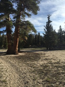
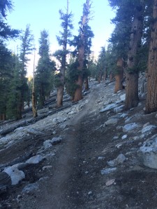
I am so blessed.  Here at mile 761.61 at elevation 10318.
I am so blessed. Here at mile 761.61 at elevation 10318.

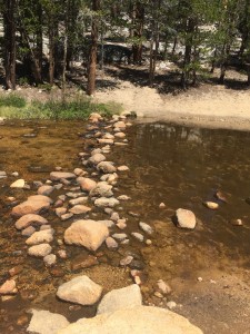
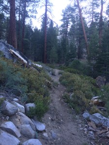
A big part of the PCT in the High Sierra’s in addition to the passes are the stream crossings which can be very dangerous. You are advised to try and forge all streams early in the morning before the run off from the snow melt starts. Here is my first stream crossing. I managed it without issue.
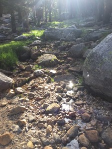
My first stream crossing :)
My first stream crossing 🙂
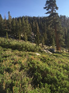
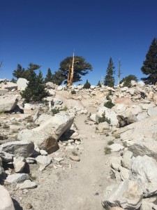
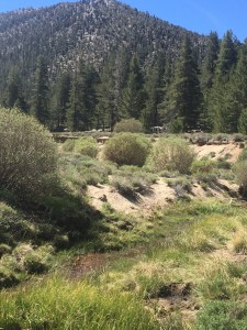
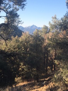
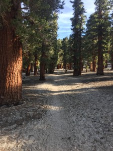
Such a wonderful hike.  Here at 10500 feet.  Large and beautiful trees.  Perfect weather.
Such a wonderful hike. Here at 10500 feet. Large and beautiful trees. Perfect weather.

There is a minor ascent up to 11000+ feet and then back down
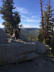
About 11000 feet here
10600 feet
10600 feet
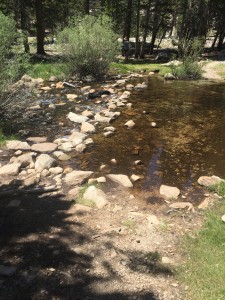
Second stream crossing that is a little bigger than first.  This is Wallace Creek
Second stream crossing that is a little bigger than first.

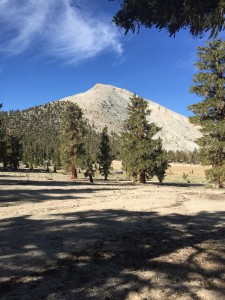
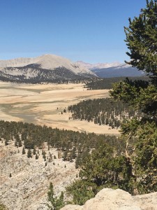
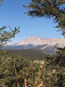
If I had not made the decision at Mt. Whitney, I would have to make it about now. This is looking from a Meadow towards Mt. Whitney and this is about where the trail forks. I took the path less taken (at least today) and did not go to Mt. Whitney. I will do that in another year with Lenora. However right here I ran into a surprise. Paul and Sam where camping in this meadow and had done Mt. Whitney yesterday. They were now heading towards Forester Pass with me. They also are going to camp at Tyndall Creek (my destination for today) and will ascend tomorrow. It is nice to see them again and to find out that Sam is ok. Last saw them at Kennedy Meadows where I was worried Sam had overheated.
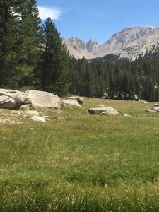
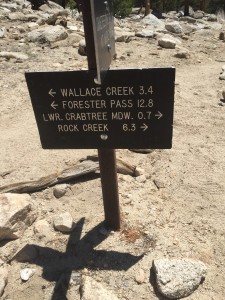
View to Mt. Whitney
View to Mt. Whitney
I take the path towards Foresters Path.
I take the path towards Forester Path.
This is Wallace Creek.  Managed not to fall in
This is Wallace Creek. Managed not to fall in

As you can tell from the pictures we now indeed have water everywhere. There are many times where small run off streams are crossing the PCT and all of them have clear cold water. Starting a bit of a climb again above the tree line and just down from the PCT is another lake.
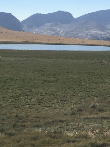
Lake at 11354 feet
Lake at 11354 feet

These cute little Marmot guys are everywhere.
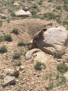
This little guy was worried about something and it was not me.  He was sounding a warning call (or so it sounded to me).  I looked uphill and downhill and in the sky and could not see his concern.  My mind was thinking bear
This little guy was worried about something and it was not me. He was sounding a warning call (or so it sounded to me). I looked uphill and downhill and in the sky and could not see his concern. My mind was thinking bear

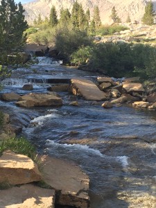
Down from the lake I reach my next camping spot at Tyndall Creek. The biggest stream so far. I did not get a picture of the fording point but it was much like the others. The rocks I had to jump from and to where pretty close together and for the most part above water. I again managed not to slip into the water. I am a little shocked at this. I have never been very well balanced 🙂
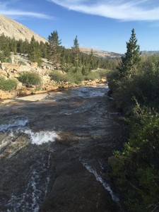
Tyndall Creek
Tyndall Creek
Tyndall Creek
Tyndall Creek

It was a nice place to camp. The water rushing down the stream could be clearly heard and it put me right to sleep. Tomorrow would be the big day to ascend Forester Pass, the highest point on the PCT.

Lenora’s Note:
Laundry, cleaning up from the cats trip to high elevation, stitching and watching now and again. The big question is; “Will Don attempt Mt. Whitney?” No way to ask so I have to watch his progress until it is clear he is giving it a pass. I would learn later he saved this part to do with me and I find myself full of anticipation and determination.
June 22 – PCT Mile 750 to 760

Had a great extended weekend with Lenora in Lone Pine and now back on the trail for 4 or 5 days. I have Foresters Pass, the highest point on the PCT looming ahead of me and really not at all sure what it is going to take to get up and over the pass. Lenora took me back to Horseshoe Meadows which is at 10000 feet and I start the 3.5 mile trail back up to the PCT and Cottonwood Pass at around 11320 feet. I am not taking the same trail back up that I took down from the PCT and the result is that I actually miss 4 miles of the actual PCT trail. It is a really nice 3.5 mile hike back up to the PCT through trees and green areas. Here are some pictures of the way…

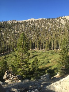
The area to which I am heading
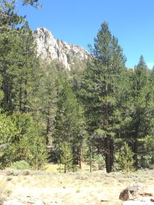
Just a beautiful area along the way back to the PCT
Some more scenery on the way back to the PCT
Seriously.... I know which way North is... well, most of the time anyway
Seriously…. I know which way North is… well, most of the time anyway

After getting back to Cottonwood Pass and the PCT there is a lake about 1 mile further down the trail. This is the first lake along the way and many at this point finally feel as if they have entered the High Sierra’s. There were a number of people camping at the lake (Chicken Spring Lake) but it is far enough way I can’t tell who is there and since I don’t need water I don’t actually go to the Lake. Turns out some of the people are the “Crew” (Just Keep Walking, Night Walker, SingleMalt, and Stubbs). They will catch me later on in the day. I also meet to other hikers just going to the lake for breakfast and they are “Doc” and “The Dude”. Older guys, not as old as me, but older that most of the PCT hikers.

Chicken Spring Lake.  First lake in the High Sierra's that the PCT crosses.  Finally perhaps the "water everywhere" promise is coming true
Chicken Spring Lake. First lake in the High Sierra’s that the PCT crosses. Finally perhaps the “water everywhere” promise is coming true

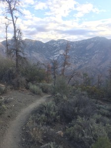
Continuing on down from Cottonwood Pass there are some great views of meadows below. At 11000 feet we are right at the tree line and sometimes venture above the tree line.

Meadow around Cottonwood Pass
Near the tree line
Near the tree line
More rocks that trees but beautiful all the way
Large Meadow down from Cottonwood Pass

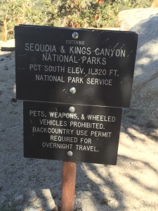
After about 4 miles, I enter into the Sequoia and Kings Canyon National Parks. It is going to get every more breathtakingly beautiful.

Moving along into more beauty
Tree line is pretty clear
Always nice to know where you are

In the early afternoon, I run into SingleMalt and a little later here comes “Just Keep Walking”, “Night Walker”, and Stubby and we all more less walk together to Rock Creek where we camp for the night. Little later Doc and “The Dude” join us. The stream (which I can’t believe I did not take a picture of) is big enough to have trout and “Just Keep Walking” and SingleMalt fish for awhile and get one trout for the effort. By that time, I am in my tent and starting to sleep but the rest shared in the catch. In later days they would be more successful and would be eating trout on most evenings.

Lenora’s Note:
Weekends are about getting clean, doing laundry, restocking, talking, sharing, catching up, going to mass and resting. This weekend had a lot of golf and a fair amount of wine. But, on Monday the Adventure resumes and so I find myself dropping Don at the trail and watching him move away. I head out of the parking lot and spy a young hiker, full pack looking hopefully at me as I slow. Are you going to Lone Pine ‘Karma Forward’ asks and I welcome him aboard. If I concentrate and the strip of road ahead instead of the wide expanse of sky around me with no visible ground I drive with more comfort. I’m getting the hang of this mountain thing.
Today we move from Lone Pine to Bishop and I have 50 miles to go and 3 hours before I can get my room in Bishop so I follow the lure of an intriguing sign that promises an “Ancient Bristlecone Forest” about 24 miles from Hwy. 395. Off we go, the cats and I, to see the ancient trees.

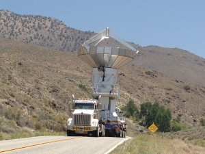
Small road, big load.  Someone is moving satellite equipment and I can only pull off road and watch,
Small road, big load. Someone is moving satellite equipment and I can only pull off road and watch,

By the time we reach 9,000 feet the first cat is throwing up but the scenery is unbelievable so I keep driving. Did his breakfast not agree with him I wonder.

Entering the Ancient Bristlecone Forest
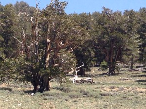
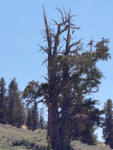
Bristlecone Pine
Bristlecone Pine

By 10,000 feet we seem to be at the plateau but now the other cat is throwing up and I begin to think it might not all be food related as I recall my experience of the first drive up to Horseshoe Meadows and the effect of elevation on me. The symptoms seem familiar.

Bristlecones
Bristlecones
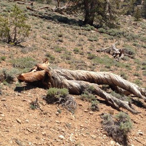
The shapes of the roots create fantastic images,  Anyone see a dog resting
The shapes of the roots create fantastic images, Anyone see a dog resting
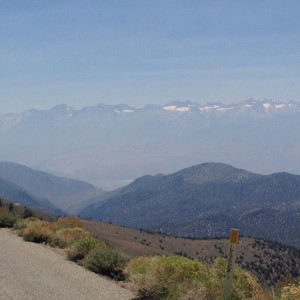
From 10,000 feet you can really see the snows on the mountains where Don is hiking,

Down the mountain we find our room is ready and we move into our home away from home in Bishop. I check and find Don has survived Forrester’s and is still moving so I can relax and unpack and arrange things. Happy face.

June 19 – PCT Mile 733 to 746

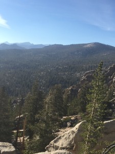
Another beautiful night. The weather has been magnificent without a cloud in the sky during the day or night. Even at 10000 feet when in the sun, it was hot enough to seek and enjoy the shade. Got up early and started walked about 5:10 in the morning. Again the day begins with a climb and I am much faster ascending in the morning. I have always been a morning person and that continues while hiking. It feels like I ascend at about half the speed in the afternoon than I do in the mornings and the mornings in the High Sierra’s are perfect for hiking. If you stand still you might want a jacket on but when hiking it is just perfect. After about 1 hour I pass 2 other hikers that are just getting up and one tells me that if I have AT&T there is a small area where you can get service. He shows me where it is. Stand right here he says and point your phone down into the desert below. What a view!!

AT&T Service from this spot.  Beautiful location.
AT&T Service from this spot. Beautiful location.
IMG_0217

Looking the other way.  Just thought it beautiful
Looking the other way. Just thought it beautiful

By the way the next water after 730 was going to be at 741. For me that is a stretch for 3 liters especially when I leave the water source and camp. I tend to drink about a liter of water during the evening meal and during the night. So that leaves me with 2 liters for 11 miles and that is a stretch. That is another good reason for walking early in the morning before it gets hot.

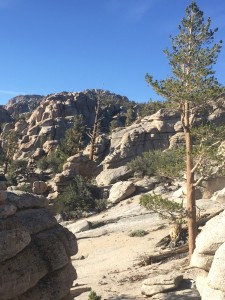
Here are some more early morning views as I am hiking along.

IMG_0220

IMG_0224

IMG_0226

When I get to Diaz Creek at mile 741 there is “Tent Talker” filling up on water as well. She did make her 18 miles but slept later and so our paths cross again but probably for the last time. She is heading over Cottonwood Pass and beyond and I am going down to Horseshoe Meadows to be picked up by Lenora for the weekend. Here is the Diaz Creek water source.

Diaz Creek
Diaz Creek

Lenora has been following my progress and gets to Horseshoe Meadows about 30 minutes after I do and she has brought up 4 other hikers with her. “Clark Kent” and “Rock City” are two of them and we have a good reunion. We just sit around and talk for about 40 minutes or so. They are heading back to Cottonwood Pass and are going to climb Mt. Whitney as a PCT diversion. I have not decided if I am going to summit Mt. Whitney or not. That will be a game day decision. Lenora has magic in the car and we feed everyone with oranges and snickers and juice drinks. As we are talking more and more hikers are being brought up by other angels and there are probably 12 or so hikers just sitting in the shade waiting for the heat to die down before they ascend up to Cottonwood Pass. Lenora and I head down into Lone Pine.
Lenora’s Note:
When we started this section and I dropped Don we both remembered the challenge of the training hike last year and we gave him a generous time to reach Cottonwood Pass and Horseshoe Meadow. I expected to be meeting him late Saturday but Friday close to noon I checked on his progress and found he was already on the cut off trail to the campground so I bundled the treats into the car and headed up the mountain road. It is less scary to drive the twisty trail than to be a passenger and I arrive at the campground to find my wandering husband sitting on the ground out of the sun. I brought “magic” so he hauls the cooler out and as hikers arrive several of them enjoy juice drinks, candy bars and the few oranges we have left. It seems to be a really poor citrus year as I shop for oranges everywhere I stop and often cannot find more than a dozen in a store. I love being the “magic” delivery person and this is how I was able to enjoy the ride up the mountain with the company. “Rock City” had actually recognized me from a previous magic delivery at Bird Pass and asked if I was heading up the mountain and if they could get a ride. Their conversation helped distract me from the curves and steep drop-offs on the road. I am reminded how present God is in our everyday lives as we go about our business rarely thinking of how much we are blessed. These hikers were walking up the sidewalk at the very moment I was closing the tailgate to drive up the mountain they needed to get to. A few minutes either way and we would have missed each other.

June 18 – PCT Mile 719 to 733

It was a beautiful clear night and the stars were amazing. I did not have my rain flap on the tent and so I could just look up at the sky. A couple times during the night when I would wake up, I would put on my glasses and just stare at the sky filled with stars and it would remind me how incredibly blessed I am to be able to do this.

I got up early in the morning to start walking because I knew I was about to start a rather serious climb. The next mile, mile 720, is where I quit during my training walk. I do declare that mile 720 is the longest mile on the PCT. It is the mile that never ends!! I remember during the training walk, I would get to some place of interest or just have to stop to catch my breath and each time I looked I would still be on mile 720!! Here are some pictures along the way

Does anybody know that this beauty is.  There are not many of them.  Very delicate
Does anybody know that this beauty is. There are not many of them. Very delicate
Simple picture of the trail
You know I love mileage signs right

And here is the very spot where I turned around on my training walk. Could not get over the tree or under the tree or around the tree with backpack on. Mile 720.99!!! This year someone had cut a way around the tree on one side and I took a picture from the other side of tree and mile 721. Finally I had made it past mile 720 🙂

The tree that ended the training hike.  Still there
The tree that ended the training hike. Still there

By the way there was water at two spots before the 14 mile sure thing. One of those spots was up in the meadow shown in the picture below. A beautiful pool in a very small flowing stream going right down the middle of the meadow and which the PCT crossed.

Going to work up through this meadow which has a wonderfully cold stream going through it
Looking back down from higher up in the meadow

Here are some pictures as I continue to hike toward the next water at mile 730.

IMG_0206

IMG_0210

IMG_0211

2 miles before the sure water at 730, the PCT crosses a little stream with water. Someone has gone to the trouble to dig out a little pool and to arrange large leaves so the water is channeled and then drips off the end of the leaves into the pool. It takes awhile because there is not much water but I stop and fill my liter water bottle. While I am doing this, “Tent Talker” and another hiker come by and the other hiker says “you know there is really good water just 2 miles ahead”. I decide to tell him the story of Queen Elizabeth that when asked how she was able to attend so many formal gathering and greeting lines in a day responded that she never passed up an opportunity to sit down or an opportunity to go to the bathroom. I said in a similar way that I do not pass up real water right in front of me for theoretical water that I have not seen. He did not seem impressed. He shrugged and walked on. Tent Talker got some water.

When I go to mile 730 there was another hiker whose name is “2 pack”. He carries two packs. One on his back and one on his front with a 40% of weight in the front pack and 60% in the back pack. He says this is the only way to go and he had fashioned his own packs for this purpose. I told him I had seen other hikers that were using the two pack system and that some manufacturer was creating this very configuration. Anyway the really interesting thing about “2 pack” is that he started out carrying 140 pounds with 40 days of food!!! 140 pounds!! He said that it was probably only about 120 pounds currently. He said he only walked early in the morning and walked from water source to water source and took frequent breaks. All his gear and clothing was camouflage and I’m guessing he was ex special forces. He told me he was the one who fashioned the pool and leaves at the previous water spot and he had done something similar at this one. “Where exactly is the water?”, I asked. He told me to go about 1/8 of a mile up a trail and I would see the water coming out of the rock. Coming out of the rock?? Had Moses been here I wondered. Did he tap the rock once or twice. Anyway, I walk up the trail and sure enough it does appear the water is coming out of the bottom of the rock. “2 pack” had dug out a hole and you could just put a cup under the rock and it would fill almost immediately. So I filled up my 3 liters and went back and talked with “2 pack” for awhile and slept for about an hour and then decided to hike on for a bit. Got to mile 733 and found a beautiful place to camp. Here are some pictures from that spot.

MIle 733 camping spot looking down
Mile 733 camping spot looking up

By the way, “Tent Talker” had a very aggressive goal of doing 18 miles a day in the High Sierra’s. So she left the water hole earlier than I and I did not expect to see her again as she would have hiked to mile 738 where there was suppose to be a good camping site.

Lenora’s Note:
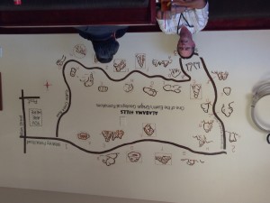
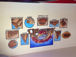
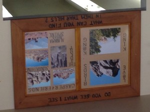
We are staying at an interesting motel in Lone Pine. Named the Portal Motel it is clearly one of the older buildings in the town but the only motel that would take the cats and let me stay a week or more, the rest are so busy they could only give us one or two days at a time. The funny part is the housekeeper will not enter the room with the cats here and so we have clean towels when we ask for them but no contact with hotel staff for most of the stay. By now the room needs to be vacuumed and mopped and so I tell the manager/owner that I will take the cats for a ride if she will just get the maid to clean the room. She agrees and we head out to explore the Alabama Hills. Why Alabama I wonder. From Highway 395 the Alabamas look like big red hills between the highway and the “real” mountains but the Alabama Hills bakery and cafe has photos and paintings of the unusual formations of the hills so I decide we need to check it out.

Some of the rock formations in the Alabama Hills are on the map.

IMG_3425

IMG_3424

We need to be gone at least an hour so with litter box, water, treats, toys and a drink for me we make the short drive to the hills. What we find is amazing. Behind the red hills are a rock climbers dream. Big and smooth and clunky they form amazing shapes and are bundled and jumbled in mountain high piles. We take one of the dirt roads called Movie Road and drive for over an hour turning this way and that until I fear we will not ever see Lone Pine again. I find myself wondering at the power of God who chose to create on this earth a landscape so wild and unreal that it has graced the backdrops of numerous western and sci-fi movies over the years and on film is still a mere shadow of the wonders of creation. I have always contended that God must have a special affection for the southwest since this part of America he did not feel a need to fancy up with green growing things or bright colors, except for the wonderful dirt 🙂 and He left this land just as he created her, wild and scary and beautiful in her own way.
Don is hiking the mountains and I continue to track his progress daily but I have grown much more confident of his trail skills and I no longer look at the computer every 30 minutes or so to reassure myself he is still moving forward. I do check however and so I noted his long rest this day and asked him how it is going. We are getting into a routine and I will be glad to see him tomorrow or Saturday.

June 17 – PCT Mile 702 to 719

So the rest of this week I was planning to go from Kennedy Meadows at mile 702 to Cottonwood Pass at mile 750 and then side trail to Horseshoe Meadows where Lenora could pick me up. This was exactly a repeat of one of my training walks but if you remember that training walk did not turn out so good. On the training walk I only make 9 miles the first day and then 11 miles the second day and then turned around when I realized I did not have enough time to get to Cottonwood Pass. I was a little concerned if I was going to repeat that effort and not be able to make it to Horseshoe Meadows by Sunday (4 full days of hiking). That concern was dispelled today as I basically hiked as far today and I had in 2 days during the training walk. I’m guessing I can attribute this to 3 things…. 1) There are about 35 pounds less of me this time. 2) I have had 702 miles of getting ready for this. and 3) especially the miles from 650 to 702 which were steep, high, and hot prepared me for the elevation change.

Here is a sign at the start of what is considered the start of the High Sierra’s.

IMG_0187

At mile 706 the trail crosses the South Fork of the Kern River for the first time. There is a nice bridge across the river and here is a picture of the bridge and a picture of the stream below where I did stop and get water. I had reduced the amount of water that I could carry to 3 liters because at this point I still believed the HYPE that there is water everywhere.

Bridge over Kern River
Nice flow of clear cold water

The next water was suppose to be at the second crossing of the Kern River at mile 716 but I was able to get water at the same spot I did in my training walk. The spot hidden down from the trail that the birds led me to during my training hike at about mile 711. All during the day a new hiker “Tent Talker” and I had been crossing paths. On different rest schedules we would pass each other while the other was resting. She said she was going slower than normal because she had 12 days worth of food. I on the other hand had only 5 days worth of food and my pack was actually lighter than it had been at any time during the trail. I did not see how anyone could get 12 days of food in a bear canister as mine was full with just 5 days. She admitted that not all her food was in a bear canister but would be by the time she got to where the bear canister was actually necessary. So anyway, the reason why we kept seeing each other is that she was weighted down more than normal and I was lighter :). When I got to the second crossing of the Kern River there were 5 other hikers there that looked like they were settled in. They were going to camp right there by the water because the next sure water was 14 miles away. Everyone really believed that the water worries were over at Kennedy Meadows and so had scaled back on the water containers they carried. Everyone was a little upset that it just was not true that there was water everywhere. Apparently the “water everywhere” does not happen until you pass over Cottonwood Pass. We could have figured this out with a little effort. One clue is that the PCT water reports continue until Cottonwood Pass and then stop. No need for a water report when there is water everywhere!! So in another 30 miles things will be as expected with respect to water. I decide to move on and hike another 3 miles before setting up camp. A little later “Tent Talker” comes by and decides to camp in the same general area. I listen for awhile but never hear her talking to her tent.. Later I find out that she got her name because she would frequently get into her tent and then start a conversation with someone outside the tent.

Lenora’s Note:
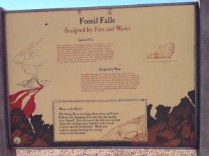
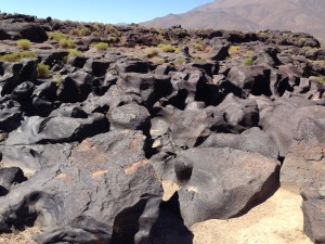
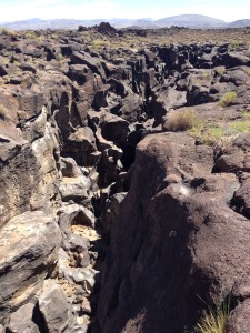
After dropping Don at Kennedy Meadows I head down the mountain. It is a long drive back to Lone Pine but I realize that we are running out of days in this area and I’ve been working on my stitching projects to the exclusion of any other pleasures so I decide that this is the day to explore the lava flow waterfall. I do not know if there will be water but the lava rock is beautiful from the road and last year I feared it was too hot to leave the cats in the car while I went for a little hike. Today with no cats I am free to explore. The real name of this area is Fossil Falls and there are no longer any falls, in fact the river bed is totally dry and has been for a very long time. What is fascinating is what the water was able to do to the tough lava rock when the river still ran and the falls crashed toward the river bed below. The photos do not do the area justice, as is often the case, and I rediscovered some of my rock climbing abilities as I clambered over the rocks looking for a better angle. I never did find the famed “fossils” of Fossil Falls but I saw some beautiful lava formations and the best were the ones carved by the water of the long gone river. This is truly a spot too good to visit by yourself as I kept wanting to call out to someone, “Come here and see this! Do you think we could climb all the way to the bottom?” But discretion prevailed and I prudently if reluctantly made my way over to view the campground before heading back to the car. The signs at the falls seem to promise some “rock art” in the form of petroglyphs but I never saw any of those either. It is now about noon and very hot and I suddenly feel the call of an uncompleted stitching project and so head back to the hotel.

Excursion to find out if the fossil falls are really a waterfall.
Standing at the head of the falls all you see is polished rock with many strange forms.
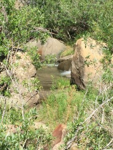
From down river looking back toward the head of the falls.  You can't really see how deep this river has cut into the earth but it would be a challenge to reach the bottom.
From down river looking back toward the head of the falls. You can’t really see how deep this river has cut into the earth but it would be a challenge to reach the bottom.

June 13 – PCT Mile 681 to 702

Really want to get the 21 miles in today and make it to Kennedy Meadows so that Lenora and I can spent Sunday in Lone Pine. So I get up at 4 and start walking around 5 I think. After about 2 miles of walking I am surprised to catch up with Paul and Sam. They also want to make it to Kennedy Meadows and so go up and started earlier that I did. I did not notice they had left already. We pretty much hike together all day. The climb to 8000 feet actually ended up being the easiest part of the day. The slope was gentle and the early morning temperature was perfect. All the time I figured it was going to be a grueling climb to 8000 feet and then a gentle slide into Kennedy Meadows which is at about 6000 feet. Just the opposite happened. The ascent was easy and the descent was difficult. The ascent was done in trees and shade. The descent was totally open and it was hot. About half way down there was a spot with 3 lone pine trees and finally a little shade. Paul, Sam, and I each rested under 1 of the trees which provided just enough shade to cover one person. It was a relief and also about this same time some clouds started moving in. Once we got to the bottom there was a water source and some shade and we again rested. There were only 8 miles to go to Kennedy Meadows and I was sure I would make it but the blisters and hip from the previous 2 days were starting to slow me down. Took a long time to do those last 8 miles. I am not sure if Paul and Sam made it because Sam was showing signs of heat exhaustion. Even with the cloud cover she was just terribly hot and was slowing down. About 3 miles from Kennedy Meadows they apparently stopped. I did not notice at the time but they were no longer behind me when I stopped to look around. I slowed down and waited but could never see them. I probably should have walked back. I wish I would have now. Lenora had been making her way from Escondido, to Lone Pine, to the motel, and then back to Kennedy Meadows. I arrived at the road at mile 702 and Lenora was not there but I knew she was on her way and close. I started to walk up the road towards the Kennedy Meadows grocery store and diner and about .25 miles into it, I see Lenora coming over the hill. She picks me up at almost exactly the same spot she found me on my training walk the previous year. I find that totally and completely amazing.

A little plateau on the way to 8000 feet
Milestone on the PCT.  2 miles is Kennedy Meadows and the start of the High Sierra's
Milestone on the PCT. 2 miles is Kennedy Meadows and the start of the High Sierra’s

Lenora’s note: It is a relief and a surprise when I actually find Don at the pick up point. I have been so focused on the parish directory that I push my leaving time to the last minute and then worry that he will have to wait too long. Somehow we have been blessed to find each other at each meeting time.

June 12 – PCT Mile 665 to 681

A good nights sleep and a fairly early start to the day. More of the same from yesterday with what seems like steeper that normal ascents and descents. Two of them today up to 7000 feet or more and then back down. Caught up with Paul and Same and got the bear story and we stayed pretty close the rest of the day and ended up camping at the same place. The camping place was again right near a water source. I would have totally missed the water source had it not been for Dave (the Dave that did not go to Rita’s earlier). Where the PCT crossed the stream it was totally dry but about 200 yards up the stream was a really nice pool of water. Dave yelled to me as I was going by and told me where the water was. He saved me a mile of walking as the other water source at this time was a full mile off the trail. Once again Dave was in a hurry to get somewhere and continued hiking while I decided to camp by the water source. But it was not just the water source that helped me make that decision. Just ahead was a climb to 8000 feet and at the end of the day, I was not interested in starting that. I had 21 miles to go to get to Kennedy Meadows. That night I gave myself about a 2% chance of being able to do the 21 miles with a climb to 8000 feet included. However, I did have two dinners that night to try and load up for the next day. I had a hot meal that included beef, noodles, rice and veggies. I then made a thick sandwich with summer sausage and cheese on a flour tortilla. I also made a second sandwich that I would eat after about 2 hours of hiking the next morning to fuel my day. It was not a great nights sleep. It was a great camping location by a water source and people kept arriving until about 10 at night. As each would arrive they would generally first loudly ask someone where the water was (I was not the only one that had no clue) and then they would have a lively conversation about their day. Normally no amount of noise will keep me awake when I want to sleep but this night was different. I could not dose off.

Not sure
Not sure
Somehow it thrives
Somehow it thrives
At the top of a crest and looking back at the rocks

June 11 – PCT Mile 651 to 665

This day starts out great with Rita’s blueberry pancakes. But then she starts to tell us about how hot, how dry, how steep the next section is and how they have had people start it and then return to them and ask to be driven to Kennedy Meadows. We laugh a little and indicate we prefer words like “gentle slope” rather than “steep slope”. After eating we get ready and jump into the truck and they take us back to the trail. Rita was not wrong but she forgot to mention the trail was also very rocky and it was the rocky part that got to me. There are generally some rocks on the trail of course but this was ridiculous. The rocks were a constant and they would not just small pebbles but rocks of size and rocks with sharp points and rocks that rolled one way or another when you stepped on them. For me, this day was the hardest day of hiking on the entire trail thus far. I ended up the day with 2 blisters and a sore hip. It just did not seem my feet where ever just flat on the ground but were always angled one way or another. About the middle of the day a bug flew into my mouth and I swallowed it. I thought, OK, I needed a little protein. but the bug was not ready to go that that easy. It either clung on for dear life or keep crawling back up my throat. I kept on drinking lots of water to try and force it down. The bug would have nothing of it and eventually seemed to get caught in the gagging zone and I ended up throwing up on the trail. Such a waste of needed food AND water. Paul was close at the time as was a new hiker Poppins which I had met earlier for the first time. At the next stop, Poppins gave me half an orange (the orange I had shared much earlier in the trail had come back to me) and Paul gave me some Oreo cookies to eat.

The rest of the group went more miles than I did. I got to the water source and called it a day as soon as I found a level spot to camp. The water source was a spring fed trough and it was about .25 miles off the trail. Straight down off the trail into a valley. When I got almost there a woman was running up the trail from the trough and indicated there was a bear down there. Sure enough, it was easy to see. The bear was down getting a drink. I sat down on the trail and watched as the bear got his fill of water and I had the following thoughts. 1) Why am I seeing a bear at this point. There should not be any bears until Kennedy Meadows about 40 miles away. I guess nobody told the bear. 2) I think I am safe because the bear is two switchbacks away from me and then of course it occurs to me the bear does not use the switchbacks and could probably bound up to me in no time at all. 3) Since bears were not suppose to be here, I did not have my food in a bear canister. I hoped that the bear did not like summer sausage and cheese which was sitting in my pack. It did not take long for the bear to move on but I waited another 15 minutes or so just to make sure. I went and got my water and then went up and told those waiting smartly a little higher up that the bear was gone.

The next day I caught up with Paul and Sam again and they indicated that the bear had started to come towards their tent. Like me, they did not expect a bear and Paul had prepared their supper in the tent. The bear apparently noticed and they saw him moving towards the tent. They both jumped out and began making a lot of noise by banging their trekking poles together and yelling. The bear paused and looked at them for awhile and then turned and went away. They were a little shaken by the experience as I would have been.

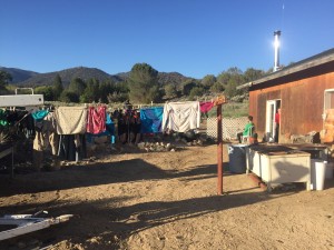
Our laundry hanging at Rita's and Richard's
Our laundry hanging at Rita’s and Richard’s

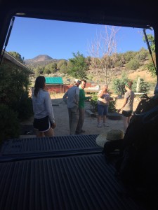
Getting ready for ride back to trail
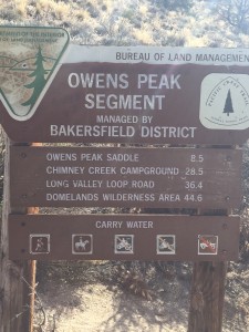
Carry Water.  Good idea.
Carry Water. Good idea.
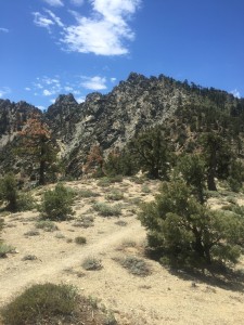
Just looking back down
Had to constantly watch your step.  Rocky trail which gave me blisters as foot was always angled some way off a rock
Had to constantly watch your step. Rocky trail which gave me blisters as foot was always angled some way off a rock

June 10 – PCT Mile 630 to 651

Get up early again this morning so that I can do the 1500 ascent before the sun is up and blazing. Was not going to get two overcast days in a row I figured and I was right. The ascent was gentle and took me up to 7000 feet. The rest of day was spent going up and down between 6200 and 7000 feet and then ended with a 1800 foot descent to Walker Pass on road 178 at mile 651. The day was hot and many times there were long periods of rest in the shade. This is the type of dynamic when you tend to meet more people because when you see someone resting in the shade you tend to think “what a great idea” and you join them. So I met up with J-Walk and Thinmint, Paul and Sam, Brit and Tonka, Dave. I had met Tonka way back at 602 but had not seen him again until one of the shade breaks today. Not a very eventful day until the end. When we arrive at Walker Campground there is another water cache but no natural water. So that means from mile 608 to and INCLUDING mile 651 there was no natural water to be had on the trail! Without the water caches and with normal temperatures this section would have to be done at night as there is no way to carry enough water to make it. I must say that I have heard that nobody has ever died of dehydration on the PCT trail. It is just the one time I had to go a few miles without water, I was miserable. The thought of walking 43 miles in 100 degree heat and at the end of that walk finding a dry water hole is not appealing. So we are at the water cache and just talking when up drives a woman and starts hauling water out of her car. She is the water cache trail angel and we all thank her and proceed to help her with the new water and consolidate the water currently at the cache to leave as many full bottles as possible. But then it really gets interesting. The trail angel’s name is Rita and she tells us that she hosts PCT hikers in her guest house which can hold 12 campers. 2 private rooms and then the rest just sleep on the floor. But wait there is more….. she fixes a spaghetti dinner for the hikers. But wait there is more. In the morning she makes a blueberry pancake breakfast and then drives everyone back to the trail. AND there are showers and you can do laundry. She does all this for an optional donation, whatever you want to provide. 20 minutes either way and we would have missed Rita. Everyone but Dave gladly went to her guest house. Dave wanted to get some more miles in and so kept hiking. It was my longest walk of the trail and I felt good at the end of the day. Even with all the heat breaks, I got in good miles and I was showered and eating a spaghetti dinner. J-Walk and Thinmint totally get what Lenora and I are doing and mention how great it must be to visit a new Church each week along the way. Life is good.

Sunrise on the desert
Climbing up to 7000 feet
Climbing to 7000 feet
Just wondering about those clouds.  Walking into rain?
Just wondering about those clouds. Walking into rain?
Going to head down that way

June 9 – PCT Mile 617 to 630

After a good nights sleep I get up early to get some miles in before it gets too hot. Based on the heat I was planning to try and find some shade and wait out the heat and continue hiking that night. As it turns out it was overcast and it remained overcast the entire day and even had a trace of rain during the day. The temperature was very mild. What a blessing. At mile 624 I come to a point where the trail crosses a road (about 8 in the morning I think) and there was a young man and his wife with a jeep. Right next to the young man (Doug) is a lot of water. I look at the water and look at Doug. Look at the water and look at Doug. I finally say “Is that your water?”. He laughs and says that the water is for the hikers. He tells me he was hired by two hikers (Coyote and Happy Feet) to haul some water up for them to this point. Rather than just bringing water for them, he brought up water for everyone. And he brought Pepsi. And he brought grapes, carrots, beer, hotdogs, tarps he set up for shade and chairs that hikers could sit on in the shade under the tarp. Just another good news story on the trail. As I talked to him I found out he has just lost his job and he and his wife were living out of their jeep!! All of that going on in his life and yet he is taking care of hikers. A little too early for beer and hotdogs but I had a pepsi, ate some grapes, downed and replaced 2 liters of water, gave them a nice tip and headed on down the trail. When I get to mile 630 there is another water cache with plenty of water. It is starting to rain and so I set up tent to wait out the rain. The rain stops soon enough but I decide to just stay at the water source for the night. The next day I hope to get in 20 miles and it starts with a 1500 foot ascent. So no water for 43 miles, turned into water at 617, 624, and 630 and I avoided the heat and actually got cooled by a little bit of rain. I say a few extra prayers of thanks this night.

Wonderful overcast day to keep the heat down.  Very lucky
Wonderful overcast day to keep the heat down. Very lucky
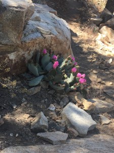
Very healthy looking
I liked to colors
I liked to colors